November 3rd, 2019
While driving the Forgotten World Highway south I listened
to a podcast with Neil DeGrasse Tyson, a brilliant scientist. Interestingly during the 2-3 hour talk he
mentioned the fact that archipelagos are made by volcanoes and it is due to a “hot
spot” on the Earth’s mantle that breaks through once in a while. The reason you can have multiple volcanoes in
somewhat of a line is that the plates of the Earth move. So the hot spot creates a volcano and then
over many many years, another fissure occurs at that hot spot and a new volcano
is born. Well in New Zealand exactly
that has happened. There’s Mount Taranaki
and Mount Tongariro about a 100 kilometres apart and both jut out from the
relatively flat surroundings. Cool. I always thought that they were just separate
cracks in the mantle. I heard this theory
and then within an hour, saw the results of it.


Mount Taranaki looks like your stereotypical volcano being
symmetrical and similar looking from all sides.
Standing over 8000 feet tall which is impressive since it starts near sea
level, it looks a lot like Mount Fuji, so much so that it was used as the
backdrop in “The Last Samurai” movie. Captain
Cook named it Mount Egmont, after the Lord of the Admiralty John Perceval, the
2nd Earl of Egmont at the time.
I looked up in Wikipedia about Perceval and it was interesting to see that
although he only lived to 59 years old, between his 2 wives he had 16
kids! Geez they needed birth control
back then. Some of his offspring died as
infants or before puberty hit but a few made it to their 80s and one of his
sons Spencer became the Prime Minister of England but was assassinated, the
only prime minister to fall to such fate.
Interesting.
Anyways, I planned to go for a hike on Mount Taranaki. I originally thought it would be cool to try
to summit it but being mid-spring, you need to have some mountaineering
experience, at least one buddy to climb with and the gear to do it. So instead I opted for a 4 hour loop up to
the snow line, across the perimeter for a bit and back down again. It actually took me less than 3 hours but I
guess they say 4 hours so people are prepared that it could take that long.

It was a pretty straight up, no nonsense hike up on a small
gravel road to an alpine hut and a big telecommunication tower at the highest point. I sat and ate my sandwich as I watched some
skiers and snowboarders descend from above.
Three of them, all older than me, walked down to the hut and I asked
them if they had summitted. They had and
started the climb at 7 am (it was now 1:30).
The ski down looked like it had taken about 10 minutes, but way better
than walking back down!


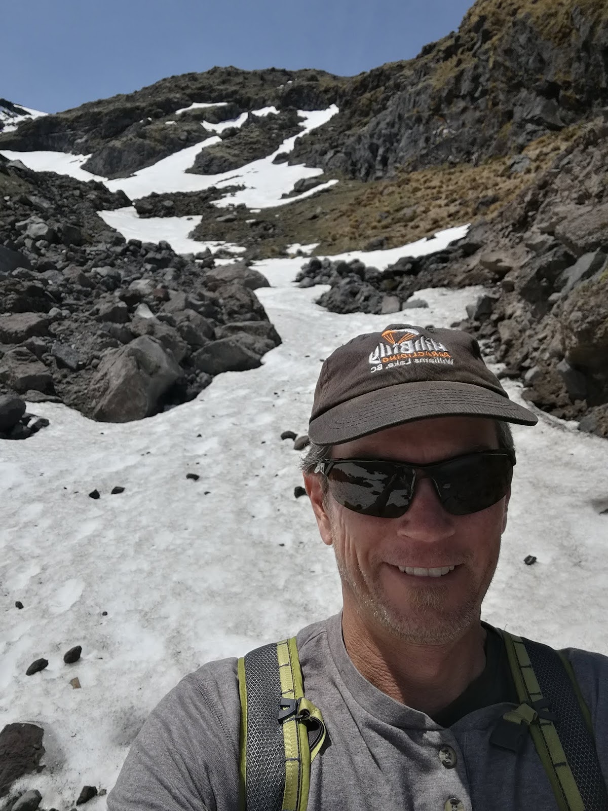


The views were pretty good and the hike was
invigorating. The way across and down
was a little more interesting as it was a proper trail and not a small gravel
road. I will contemplate coming back after
returning from the south island as I guess it’s much easier to summit in the
summer time with most of the snow gone.
My freedom camping spot for the night...had the beach to myself.

And a gorgeous sunset to boot.


No comments:
Post a Comment