July 3, 2012
Okay, unlike most of my posts, this one is going to be more
about pics and videos rather than my verbal diarrhoea (everybody likes picture books
don’t they?)....so here it goes:
After just over 7 weeks in Bir I have accumulated 34 flights
and 71 ½ hours of flying time...WOW! And
it is big mountain flying that has also provided me with a number of personal
bests:
- - longest flight in distance
- 83 kilometres out and back
- - longest flight in time
- 5 hours and 8 minutes
- - highest altitude above sea
level – 4682 meters
- - highest altitude gain from
launch – 2297 meters
- - fastest sustained thermal –
1400 meters in just under 5 minutes (about 5 m/s up average)
- - most pees in a flight – 3
(along with my 1st pee in flight)
So on with the picture show....
Looking at Barot Valley to the north of Bir:
Looking east high above Billing:
"Whoa..."
Super high above the valley with Bir on the left and Chougan on the right:
A happy Ron has just landed:
On glide:
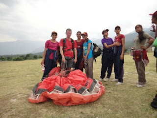
One day a school of girls from the Punjab showed up and were quite interested in what Matthew and I were up to kiting in the landing field...we definitely felt like rock stars:
Looking towards a peak known as Waldo:
After a week of my poor nose getting fried by the sun, drastic action had to be taken so I fashioned this nose protector from the inside of an empty cigarette pack I found on launch...and it worked surprisingly well (even better after a couple of days and the slight stench of tobacco had dissapated)
Looking down at Billing, the launch area:
Getting near the big boys:
Obligatory foot and snow capped mountain pic:
Approaching Mill's Peak...feeling pretty small:
The top spine keeps going to Dharamsala:
This is the way out to the main valley...sure wouldn't want to have to walk from here!
Even higher above Bir...it's gonna take a while to get down from here:
Ron ridge soaring up to the top of Mill's Peak:
Me further along the ridge (thanks for taking the pic Ron!):
Ron feeling small:
You can just spot Ron in the middle of the photograph. This is looking north from near the top of Mill's Peak at 4000 meters above sea level:
Another day, wearing someone else's balls, I headed alone north along this small ridge on the left to that back mountain and did a circuit of the back bowl:
Beautiful little waterfall I witnessed as I reached the mountain in the previous pic on the left under the cloud:
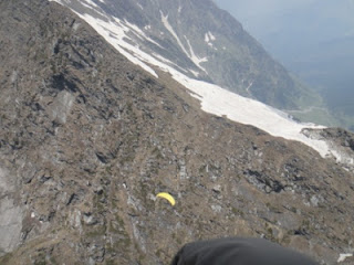
Catching a well needed thermal on the back mountain. If I sank out here I wouldn't be back in Bir until tomorrow!
Heading west from Barot Valley:
Just reaching a mountain known by paraglider pilots as Toblerone:
Ridge soaring Toblerone:
Getting high enough up on the Toblerone ridge to see the big mountains to the north:
Just seeing over the Toblerone ridge:
If I sank out here I would have to hike about 13 km straight down this valley to get to civilization...best not to think about it!
The jagged edges of Toblerone:
Heading towards the back of Mill's Peak, finishing my circuit. I ducked around the lower bit on the left where I got pummeled with sink and strong wing and even a bit of rotor but I eventually got out of there:
Landing after a great flight:
Ron and I did a top to bottom thanks to the menacing clouds...honestly the camera makes it look worse than it was:
The ridges near Billing while on a smooth late afternoon flight:
I would like to thank brothers Naresh and Suresh of the
Classic Surya Hotel in Chougan (the Tibetan Colony) for making their place feel
like a home to me. And hats off to the
cool solo pilots I met in Bir: Matthew from the US, Thomas from Switzerland,
Ron from the US & UK and Steve from the UK.
Thanks for making it a fun month and a half boys!
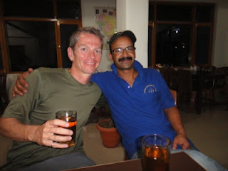
Sharing a last beer with Naresh:
I shall return...


No comments:
Post a Comment