Tuesday, December 31, 2019

A Christmas Eve Disaster

December 24th, 2019
On the recommendation of Braden, and from some of the research I’d done, I booked  the Tongariro Alpine Crossing, rated as one of the best one day hikes in New Zealand and also the world.  I had heard about the hike when I was at Mt. Taranaki, its sister volcano about 200 kilometres away, but didn’t know much about it.  I decided to do it on Christmas Day, figuring it might be pretty quiet plus it just lined up with my itinerary.

So I set out from Castlepoint for a 3-4 hour drive to a campsite called Mangahuia near the mountain.  A few hours into my drive I stopped at a viewpoint which was a bit different than your usual viewpoint.  Sure, it had a nice view of valleys on either sides of the small ridge I’d driven up, but it was a windfarm.  Te Apiti is one of the first windfarms in New Zealand with 55 wind turbines generating enough electricity to power 30,000 homes.


The cool thing was that you could walk right up to the base of the turbine…I’ve never been so close to one, nor had I heard the whooshing sound made by each blade as it passed by its lowest point in its rotation.  If you followed one of the blade tips with your eyes for a couple of rotations, you could tell that those things were really moving!  Ironically, I had just read a news article online about Donald Trump complaining about windmill farms with ridiculous claims such as the harm of toxic fumes released into the atmosphere during their manufacturing and that they created “bird graveyards” beneath them…what a dolt.  Anyways, I thought it was a cool experience.

Whoosh, whoosh, whoosh...
A lovely vista en route:
About 50 kilometres from my destination I passed a sign saying “Tangiwai Disaster Memorial”.  I didn’t know what is was about and continued on for a few more kilometres before I decided to look it up on my phone.  Turns out it was a railway accident that happened on Christmas Eve of 1953.  Shit, it’s Christmas Eve today, I must go check it out.

I backtracked and pulled into the parking area of the memorial.  There were a few covered shelters with information boards, a monument and the number plate from the locomotive.  Only one other car was in the parking lot with a gentleman leaning up against the hood of his car.  I thought I saw him wipe his eyes before sitting back in his car and remaining there for another 10 minutes.  I wondered whether he was here to remember a lost family member, but it was a fairly long time ago and he looked like he would have just been born around that time, but it still is plausible.

The locomotive engine plate:


What happened was a train from the capital city of Wellington was headed to Auckland, chock full with people going to spend Christmas with loved ones.  A lahar let loose and smashed out the railway and nearby road bridge.  I hadn’t heard of a “lahar” before, and likely you haven’t either.  Well a lahar is, thanks to Wikipedia, a violent type of mudflow or debris flow composed of a slurry of pyroclastic material, rocky debris and water.  There are a number of different ways that a lahar can happen but just think of it as a dam bursting of built-up water, rocks, debris and perhaps lava up on a volcano which flows rapidly and violently downhill.

Where it happened:

The memorial:

In this case an eruption in 1945 emptied a lake, very originally named “Crater Lake”, and then dammed it up with volcanic rock.  The lake refilled with water and eventually broke the natural dam and all hell broke loose in 1953.  The rush of water and debris smashed the railroad bridge and a road bridge just after 10 pm.  A motorist named Cyril Ellis stopped his car just short of the washed out bridge on the highway.  Upon hearing and then seeing the light of an oncoming train on the tracks nearby, he rushed out to the railway and frantically waved his flashlight. 


The engineer slammed on the brakes and his fireman shut off the oil supply to the fire but it was too late.  The train slowed but the locomotive flew off the edge and smashed into the bank on the other side of the river.  The tender and five second class cars flew into the river and a sixth dangled precariously from the tracks.  The crashing sound was heard up to 15 kilometres away.

The devastation:


Unfortunately, 151 people perished although 134 survived, some thanks to the heroic efforts of people like Cyril (the guy waving his flashlight) who helped pull people out of the dangling railcar before the couplings gave way and it plunged into the river.  It still remains as New Zealand’s worst railway disaster.


Tangiwai ironically means “Weeping Waters” in Maori.  It must have been a very sad Christmas for many people that year, and for years to come.

Thursday, December 26, 2019

Castlepoint

December 23rd,2019
Upon Braden’s recommendation I headed to Castlepoint, almost 2 hours from the lake where I was camping near Featherston.  All I knew was that it was a nice beach with a lighthouse and Irwin informed me via text that morning that there was a possibility to paraglide there.  The drive was picturesque in the latter half, passing along grassy knolls, farmland and the occasional stream.  Arriving at Castlepoint, a small villa by the sea, I wasn’t overly impressed at first.  Sure, nice sandy beach.   I could see the waves were decent as there were a handful of surfers on the water.  Off to the right was the lighthouse up on a small promontory…but it didn’t blow me away by any means.  Perhaps the low hanging grey cloud and light rain didn’t help and I’m just getting picky having been in New Zealand for a few months, the bar has been set high!


Looking towards the lighthouse:


I stopped in at the only store in town as I was desperately low on Kleenex.  If you know me, with my fairly constant hay fever, I never go anywhere without tissues in my pocket.  The store was a combination of corner store and take out restaurant with fish and chips and other deep-fried items on the menu.  The store side of it was a bit bleak.  The shelves were rather sparsely stocked and at first I thought I’d be blowing my nose with toilet paper for the duration of my visit but luckily I located the 3 half tissue boxes for sale and grabbed one for about triple the price it would have been in the city, but I was happy.


I drove further through the hamlet, towards the lighthouse, where the freedom camping spot was located.  It was tucked behind a sand dune and it wasn’t until I walked up the small dune that I really got a sense of what this place was about.  There was a sandy beach in a well protected cove.  The left side was a ridge of rocks coming down from the lighthouse but on the right there was this massive jutting out monolith called Castle Rock.  Castlepoint and I assume also Castle Rock were named by Captain Cook in 1770 as he thought it looked like an actual castle.  The rock is an interesting geological feature that sticks straight up about 200-300 meters.  I had to go check it out.

Castle Rock:

After walking across the hardpacked sand, I began to climb the switchback path up the hill.  The wind was coming in pretty hard from the south along the coastline, maybe 30-40 km/h.  The higher I got climbing up the side that was facing inland, the slightly more concerning the wind was.  I knew I wasn’t going to get blown over by it, but it did make me tread trepidatiously.  I was the only one up on the hill and the views were stunning.  Right at the top I did double over and kept a hand on the ground just to make sure that a sudden blast wasn’t going to topple me over as it was a steep slope and the grass wasn’t going to stop you tumbling!  As I neared the edge, I even got down on all fours to approach it.  I was probably over-cautious as a group of four males came up as I started to descend.  It was one adult with 3 young teenagers.  I noticed that the adult, who should be the sensible one, was wearing flip flops…so obviously it wasn’t that bad, or he was a bit crazy…maybe a bit of both.

Deliverance Cove: named so as it was a refuge from strong seas to some of the first European sailors to arrive there.

The coastline to the south:

Looking towards the lighthouse:

Getting closer to the top:

You don't need hair products with wind like this...

Looking down the cliff...maybe 4-500 feet.

Returning to Betty 2.0 via a path that ran along the ridgeline instead of on the beach, I drank some water, dropped off my jacket and went for the shorter walk up to the lighthouse. 


It stands 52 meters above the sea and is surprisingly only one of two left in New Zealand with a rotating beam (all the others must flash I guess).  Of course it’s automated, as of 1988.  I started to climb up some stairs further out on the point and noticed and encased camera.  A sign stated that there was a live feed on www.castlepointlighthouse.com.  I quickly looked my phone and saw that my sister Sarah and stepsister Corinne were online.  I texted both and sure enough they were able to see me waving at them…how cool is that?!?  Across the biggest ocean in the world and there I am waving at seemingly nobody like an idiot but they could see me!  I joked with Corinne that I should moon her but then a grandmother, mother and kid in a pram showed up so not a wise idea.


The lighthouse and Castle Rock in the background.

There's a good view of Castle Rock on the right.

Turns out I agree with Braden, Castlepoint is a sweet spot in New Zealand and I’m glad I checked it out.

Wednesday, December 25, 2019

Paragliding at Ocean Beach

December 21st, 2019
Braden hooked me up with a local pilot Irwin, originally from Holland.  He stopped by Braden’s place to pick up a radio charger and we planned to meet up in a small town called Featherston, about an hour from Wellington.  Irwin was going to pick up another pilot Felix on his way out.  In Featherston, I hopped into Irwin’s car and we drove another 40 kilometres to Ocean Beach.  Braden told me about this place the night before and said it can be epic.  It starts with a 200’ ridge by the ocean and if you’re paragliding and the conditions are right, you can pretty much start by walking or kiting your wing 30-50’ up a sandy ridge from the beach, start flying back and forth and work your way up to the top of the ridge.  But that’s not the end of it, not only can you fly 3-4 kilometres down the ridge towards a lake, if you go the other way you can bench up across a couple of spurs and possibly hook onto a mountainside that climbs to 3000 feet!  Wow.

There were a number of hang gliders in the air when we first arrived...that's what that smudge is in the middle.

Felix was a relatively new pilot, only 60 some flights although he used to be a commercial pilot on smaller planes including in Canada flying out of Abbotsford.  He had a change of heart and realized that he was becoming a glorified bus driver who was contributing big time to global warming, so he went back to school to obtain a degree in environmental studies.  Good on ya.  We both let Irwin show us the ropes of how to kite up the sand at the base of the ridge, take off just 5-10 feet off of the ground, make multiple small passes along the ridge and climb your way out.  It took Irwin a couple of tries but sure enough he was up and away.  Pretty cool to start 50 feet up and then make your way up above the 200 foot ridgeline and beyond.

You can see the small ridge on the right, then the big boys on the left.


I kited my glider up the sand and made 3-4 attempts to launch but each time I just hovered a few feet above the ground and then promptly landed.  The wind was no longer coming straight in to the cliff but from the right so on my last attempt I was in the top left hand corner and flew maybe 100-150 meters along the ridge into the wind but did not gain any height to climb out.  Eventually Felix and I decided to hike up to the launch as at this point, Irwin had been enjoying the air for over an hour.

Tough to make out, but there is a hang glider at the launch, just to the right of the lowest point of the sky in the picture.  The sand in the foreground is where we are going to attempt to take off from.

The launch was not for the faint hearted.  It was a plateau with a grassy field where I assume sheep or cattle often grazed.  As we arrived there Irwin came in to top land and the last 20-30 feet the air was not kind to him, he was obviously in some rough turbulence but he managed it well.  A fence ran along the ridge, just 10 feet back from the edge, but there was an open gate which was the launch point.  Anywhere back from the edge though, the wind was blowing out to sea, the wrong direction (thanks to what we call rotor, like an eddy in a river).  I wished I had a hang glider handy as it would have been an easy launch with a hang glider.  But instead I had to lay my paraglider out just outside the fence and stand 15 feet lower down on a steep and uncompromising slope, facing uphill with only about 5 more feet of terrain below me before it dropped away.  A couple of guys, including Irwin, held my wing up and it was basically an inflate, turn around and fly away type launch…not for the faint of heart.

This was on the walk up to take off after Felix and I gave up on the beach launching.  There's a hang glider right in the middle of the picture.


But it was all so worth it.  What a lovely ridge.  I cruised up and down the main ridge by launch and watched as the guys helped Felix to launch.  He did well with such little paragliding experience.  After a while I crossed a 100 meter gap to hop onto another part of the ridge heading towards the lake.  There was a collection of identical holiday looking homes, obviously some kind of resort, set back from the cliff.  Large parts of the clifftop was farmland with sheep munching away on the grass.  I did have one funny interaction with one sheep watching me intently as I flew by right at ridge height.

The plateau on top.  Launch is just right of center.  Sorry, I was pretty rubbish on taking pics this day.  I didn't have a camera for in-flight and I was more preoccupied with flying than trying to take photos.


Three or four times I crossed over to the ridgeline that wasn’t a flat plateau, but instead had some higher peaks and a gentler, tree covered slope below.  This is where you attempted to get higher and higher and eventually connect on to yet another higher mountain ridge.  The wind was still a bit cross so it didn’t provide great lift but it sure was a fun challenge.  Cruising back and forth about 100 meters, I would occasionally gain 10-20 meters but then quickly lose it again.  I never was able to climb up and away but I didn’t see anyone else do it at this point of the day, about mid to late afternoon thanks to this cross wind.

Felix pushed his luck trying the same thing and ended up sinking down too low and landed on the beach.  The winds were lightening up and I’d had my fill so I flew back and landed near Irwin’s car and he landed there a few minutes later.  We packed up our wings and Felix arrived having walked along the beach about a kilometre.  I flew for close to two hours and could see why Bradon was raving about this place…what a site.

Driving back to Featherston (side note: seems like almost every “town” had the ending “ton” in its name around here: the capital Wellington, Carterton, Masterton…), Irwin mentioned that the forecast for the next day was wind from the north, not good for Ocean Beach but good for another site nearby.  I decided to camp at a lake near Featherston and meet up with Irwin in the morning.  Unfortunately, it was too windy that day but it looked like Ocean Beach could be on again the following day so I stayed by the lake again…but in vain.  It was super windy the next day.  Oh well, I did get a little taste of the good stuff.

Betty 2.0 at the lake:

It was a nice spot for sunset:


On to another recommendation from Braden, Castlepoint.

Tuesday, December 24, 2019

Back to the North Island


December 19th-20th, 2019

The drive to Picton was uneventful, some nice views near the end but not the prettiest ride I’ve had in this country…I think my expectations are a bit high at this point.  I didn’t return to the “holiday campsite” in town where I’d stayed at when I first arrived on the island but opted to go a bit out of town to a spot called Whatamango.  I mean come on, what-a-name!  It was a blustery night but I was protected by some trees and bushes so it was fine.

Before I left the Nelson area, I played an 18 hole disc golf course that was in a park with large trees and nice gardens (kinda seemed like a strange fit).  This is one of a handful of obsurd holes...the basket is way in the distance in the middle of the picture.
Interesting clump of trees, some dead, some living...


Lots of raw logs heading somewhere overseas...my guess would be China.

A ferry as I pulled into Picton, different company than I will sail with tomorrow.

I've never seen a dog being transported like this.  Felt sorry for the little guy although he didn't seem to mind as he laid down for a nap as I was watching him.

The big footed Pukeko bird.
I checked in at the ferry around 7:45 am for the 9:05 sailing, you had to be there at least an hour before departure.  This time Betty 2.0 ended up on the outside portion of the upper deck.  These ferries are definitely more complicated to load than BC Ferries where you simply drive on and then drive off.  Here some cars are pointing one way, some the other way, some are curved at an angle.  It seems a bit inefficient as it does take a fair amount of time to load and unload vehicles.  There also seems to be a lack of seating in the regular lounge for the number of passengers and another complaint I’d have would be that the selection of food was quite limited.  I didn’t check out the cafeteria until we’d left the southern island, about an hour into the trip and started sailing in the more open ocean (once the interesting scenery had disappeared).  By then, there were a handful of overpriced sandwiches left or you could order a hot dog, chicken nuggets, fries…none of which seemed appealing at 10 in the morning.  Where was the breakfast menu?  People bitch about the BC Ferries, but they do get some things right.

There's Betty 2.0 in the middle.

Leaving Picton.

Bye bye south island.


Nearing the gap to the open sea.


This is the covering over the lights in the lounge on the ferry...yes, this country does live and breathe rugby!


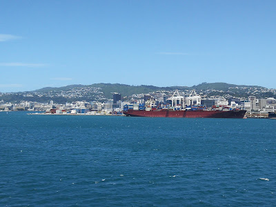
As we entered Cook Strait between the islands, even though it was a relatively calm day, the 1-2 meter swells did make walking around a bit challenging, something I haven’t experienced in the same manner, even on a stormy day back in BC.  It was kinda fun, especially watching others navigate their way around.  As we approached Wellington, which is pretty much straight east from Picton (it’s funny, you think well I’m going from the south island to the north island so I must be heading north…not so much in this case), the wind picked up and so did the whitecaps.  It was nice to see the capital city on a sunny day rather than the low overcast rainy day on my way south 5-6 weeks earlier.


My plan was to meet up with my friend Braden whom I’d met in Canada in Revelstoke.  He’d also visited the flight park in Lumby a number of times (read: he’s a paraglider pilot).  His girlfriend Sarah is originally from the Toronto area and is now living here in Wellington too.  Braden works as a brewer at a you-brew place called “The Occasional Brewer”.  Sweet.  I was instructed to come by at 3pm to help his dad Wells and brother Storm bottle some beer.  Sounds good to me!

The waterfront:

I had a bit of time to kill before that so I returned to the national museum called Te Papa.  On my way south I had only time to check out the Gallipoli exhibit so this time I got to see some other parts of the museum.  It is an impressive place and it still blows me away that it’s free to enter…well worth the price of admission!

Death from above in the museum!

Skeletons of the extinct Moa...they would have been scary birds.

This is a cannon from Captain Cook's ship the Endeavour that was in the ocean for over 200 years!  His ship ran aground in the Great Barrier Reef so they jettisoned any weight they could, including 6 cannons.  This one was salvaged in 1969 after being dumped in the sea in 1770.  Crazy!

Love the line-up of these gulls...all nose into the wind.


Driving to the brewery I could not find parking anywhere, although I was confused by the signage.  Most of them stated that “Coupon Parking in Effect” and I had no idea what that meant.  Finally I thought I’d found a spot but it was on the lane that had “Bus Lane” painted before and after my spot.  The sign beside where I parked just stated “Parking at Other Hours” or something to that effect.  Well I didn’t know what the hours were (for the bus lane)…so I admitted defeat, drove to Braden’s apartment and parked near there, and walked 20 some minutes to the brewery.

I had fun with Wells and Storm bottling the beer and had a few pints with them as Braden finished his final shift of the year.  His mom Karen picked us up and Sarah’s mom Sharon from Mississauga was visiting too.  We’d met in Revelstoke a few years before when the band Daring Greatly were playing.  I had a lovely dinner with the family and camped out in Betty 2.0 in their parking space.

Sarah gave me this beer...love the label.


The following day Braden hooked me up with another paragliding pilot to go flying…what kind people.  Braden’s family was flying back up to Auckland that evening while Braden, Sarah and Sharon were getting on a ferry to head south for the next 10 days or so.  I’m glad we were able to connect.